Ground Penetrating Radar (GPR) Survey Services
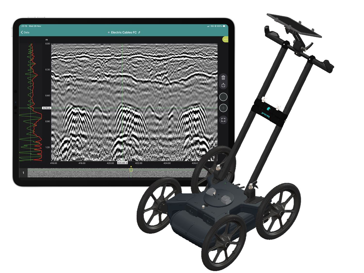
Ground Penetrating Radar is a non-destructive geophysical survey method. The equipment transmits electromagnetic pulses into the ground and records reflections from boundaries with contrasting electromagnetic properties. Processed data can support underground-utility mapping and identify disturbed ground, voids, loss of contact beneath slabs, and anomalies that may be associated with moisture or subsurface erosion.
Where GPR can help
- Mapping buried pipes, cables, manholes, pits and structural features.
- Investigating voids or loss of support beneath industrial floors, roads and yards.
- Supporting water-leak investigations by mapping anomalous responses or changes over time.
- Investigating possible washout, erosion pathways and water-related defects around slabs, embankments, drainage routes, tanks and buried services.
- Reducing uncertainty before drilling, excavation, injection or intrusive repair.
Survey workflow
- Review drawings, incident history, operational constraints and the engineering question.
- Design survey lines or a grid and select antenna frequency and equipment for the required depth, resolution and access.
- Acquire position-controlled data using a survey cart or low-clearance configuration where required.
- Process the data, classify responses and correlate intersecting survey lines.
- Map anomalies and prepare CAD/3D outputs with priorities for targeted confirmation.
- Recommend appropriate verification and the next engineering action.
Deliverables
Deliverables may include a survey-route plan, estimated target locations and depths, radar profiles, anomaly classifications, CAD/3D drawings, field records, interpretation limitations and recommendations for confirmation. HSE documentation and work methods are adapted to each operating facility.
GS8000 equipment and survey applications
The Screening Eagle/Proceq GS8000 is an ultra-wideband GPR system using stepped-frequency continuous-wave technology. It supports real-time 2D and 3D subsurface visualization and GNSS-positioned survey results.
- Underground utility locating and mapping.
- Damage prevention and excavation safety before drilling or earthworks.
- Investigation of voids, loss of contact and subsurface anomalies beneath slabs, roads and yards.
- Geophysical, infrastructure, road and bridge investigations.
- On-site digitization of findings and export for CAD/GIS workflows.
Equipment and application source: Screening Eagle Technologies, GS8000 product information.
Important limitations
GPR detects electromagnetic contrasts and anomalies; it does not automatically prove that a pipe is leaking or uniquely identify every buried material. Clay-rich, saline, highly conductive, saturated, heavily reinforced or congested environments—and targets beyond the practical depth range—can reduce penetration and interpretation confidence. Results may need confirmation using acoustic leak detection, pressure testing, moisture measurements, thermal imaging, electrical resistivity, pipe CCTV, tracer testing, trial pits or verification drilling.
Demonstrated capability
URETEK Vietnam has been selected to perform a GPR survey package at a multinational manufacturing facility in Vietnam. The required scope combines utility-route and access-point investigation, multiple equipment configurations, safety documentation and bilingual technical reporting. Project-identifying details remain confidential.
Read the technical article: How GPR Supports Water-Leak and Subsurface-Erosion Investigation
Need to locate buried infrastructure, investigate loss of support, or narrow down water-related anomalies before repair? Send URETEK your drawings and problem description for a targeted GPR survey proposal.